

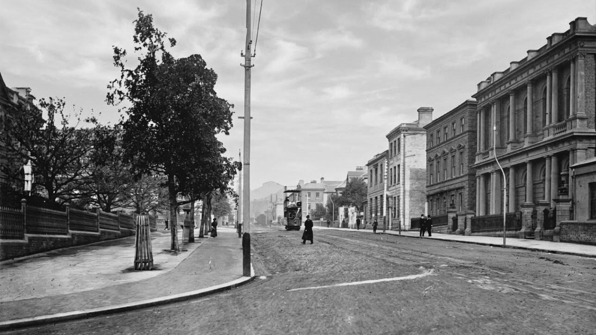
Macquarie Street is one of Hobart’s original streets.
When the British established Hobart Town at Sullivans Cove in 1804, they did not develop a coherent street plan for the settlement. Instead, they simply let it grow organically, with rough structures, paths, roads building up around the Hobart Rivulet.
In November 1811, New South Wales governor Lachlan Macquarie visited Hobart and found himself feeling dissatisfied with its irregular layout.* He ordered a new survey and the creation of a planned grid of streets with footpaths on either side. Macquarie Street was one of the main east-west axes of this new plan and was named in his honour.
This 1811 layout remains the foundation of Hobart’s CBD today.
From the 1820s to the 1840s, as Hobart grew into a fully-fledged colonial town, Macquarie Street became lined with shops, inns, government buildings, and residences. St. David’s Cathedral was later constructed on the street in 1874.
During the early 20th century, many of the early residential buildings along Macquarie Street were replaced with offices, banks, government buildings, and newspaper premises.
In 1965, the Hobart Area Transportation Study proposed converting Macquarie Street and Davey Street into a temporary one-way traffic couplet to improve traffic flow through the city until the completion of the Northside Freeway, a project that was ultimately abandoned.**
Macquarie Street was officially changed to one-way traffic through much of Hobart on 15 August 1877. Davey Street followed suit in 1987.
* The governor of New South Wales originally had jurisdiction over Van Diemen’s Land.
** The Northside Freeway was a 1960s proposal in Hobart to build a freeway bypass through the city. It would have run from the Southern Outlet near Davey Street, crossed the Hobart Rivulet and Queens Domain, and linked the Brooker Highway with the Tasman Highway to move traffic away from the CBD. It was never built because it was too expensive and planning priorities changed.
References & bibliography
- The Names of Hobart: City Streets (Our Tasmania)
- A Sense of Place: Hobart City Architectural Walk (Our Tasmania)
- City of Hobart Planning Scheme (1982)
- Item 131 – Macquarie Street, Hobart – looking north (University of Tasmania)
- Kingston and Environs Transport Study (2006)
- Congestion in Greater Hobart: Summary Report (2011)
- Hobart tunnel could be viable says economist (ABC News)
- Hobart Area Transportation Study (1965)
Tas That Was is a column that includes:
- anecdotes of life in Tasmania in the past;
- historical photographs of locations in Tasmania; and/or
- documentaries about locations in Tasmania.
If you have an anecdote or photograph you’d like to share with us, please send it to [email protected].
Callum J. Jones is passionate about telling stories. He studied English, History, and Journalism at the University of Tasmania and lived in Western Sydney from 2022 to 2024 while working as a journalist for Professional Planner, a leading online publication for financial planners. Callum has written for Tasmanian Times since 2018 and has also been published in a range of other outlets, including Quadrant and the BAD Western Sydney anthologies.
If you’re interested in this article, please join our mailing list. It’s all free … and we won’t share your information with anyone!
If you have any comments you’d like to add to this article, please contribute via this form. We’re trialling this while we work through replacing our comments section.
Truly independent media is a cornerstone of democracy.
Remember: once they gain power the first action of every despot in modern history is to take control of the media, so please consider supporting us.
Your kids will thank you and so will your Granny, but the aspiring despots won’t…